 An official website of the United States government. Here's how you know.


This World War I Battlefield Tour includes Google Maps links at each stop. Travel along virtually by clicking the link for each stop, or map the full route and take a drive along this historic battlefield route in France.
An important strategic, psychological victory
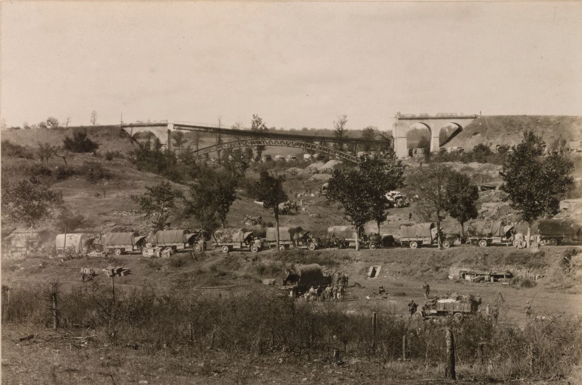
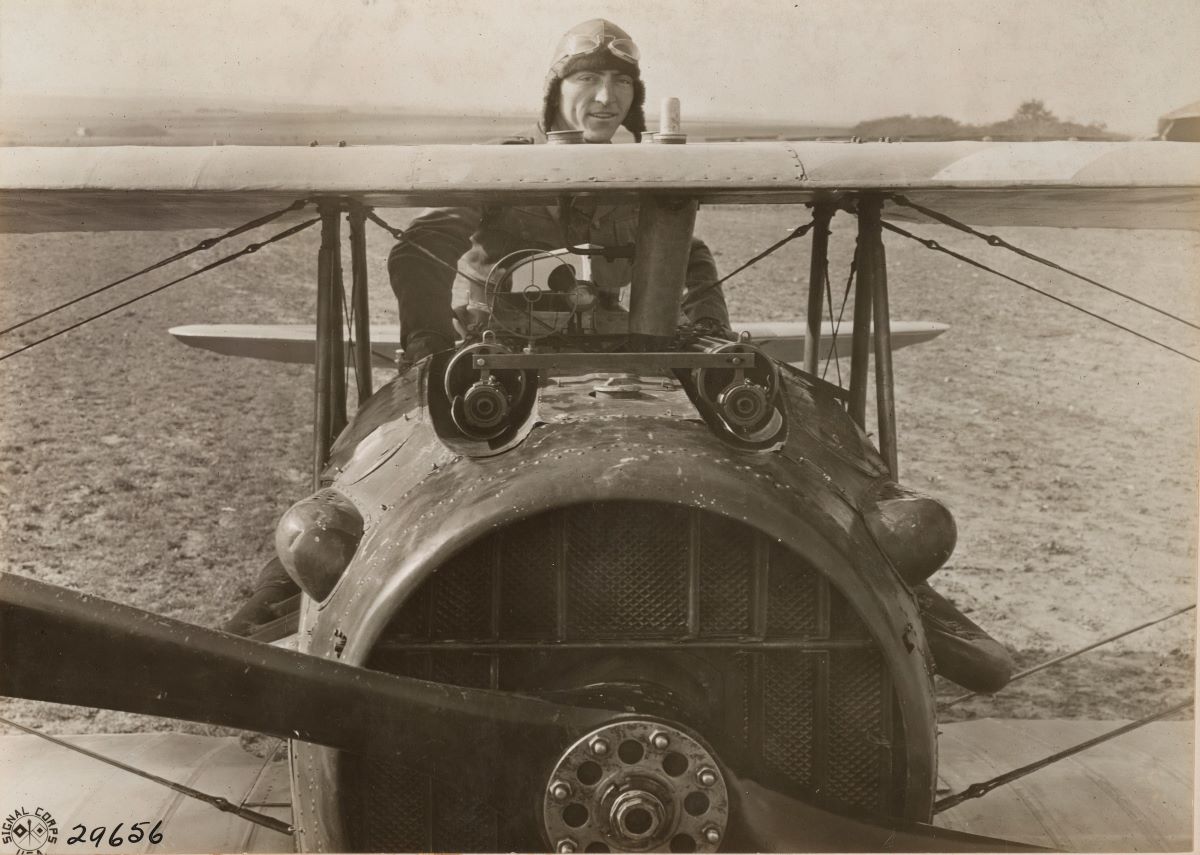
For the American Expeditionary Forces, the Battle of St. Mihiel was an important victory for strategic and psychological reasons. When the battle took place in mid-September 1918, many soldiers in the American Expeditionary Forces had already experienced a baptism of fire in the war. In addition, a vast supply network – the Service of Supply – brought men, supplies, and material to American Expeditionary Forces and Allied armies from ports in western France. Allied fliers and Americans of the U.S. Air Service manned nearly 1,500 aircraft under Gen. Billy Mitchell. The Americans took the lead in this battle, supported by the French and British, and demonstrated that they were every bit as capable as their allies.
American divisions had previously fought within the command structures of the French and British in the sectors controlled by those armies. To move under its own command structure, the American First Army was organized on Aug. 10, 1918, under command of Gen. John J. Pershing. It contained the I, IV, and V American Corps, and the French II Colonial Corps. Many American support troops were attached to the First Army, as were numerous French and American artillery and aviation units. The chosen target of this force was the St. Mihiel salient, a rough triangle jutting into Allied lines 56 kilometers wide, and 32 kilometers deep, with the small city of St. Mihiel on the Meuse River south of Verdun at its southwestern point.
The St. Mihiel Salient was created by German units supporting attacks on Verdun. One side of the salient faced west from Haudiomont to St. Mihiel. From there it faced south to the Moselle River above Pont-à-Mousson. The new position complicated the supply to French forces at Verdun, and further south threatened the Paris to Nancy rail line. A stalemate ensued around the salient. By fall of 1918, the German Army planned to retreat from the salient to a shorter defensible line between Pont-à-Mousson and Haudimont. The American attack was scheduled for the morning of Sept. 12, 1918. The day before the attack, the Germans had begun a controlled, methodical withdrawal.
The American First Army would attack all around the salient. On the south side the American I and IV Corps, with several divisions each, faced a 24-kilometer front from the Moselle River to west of the town of Seicherprey. From there the front ran west past Apremont to the Meuse River and then curved around St. Mihiel to the northeast by the town of Mouilly. This area was covered by the French II Colonial Corps serving with the American First Army. The American V Corps’ front ran from Mouilly northeast for almost 5 kilometers and then curved northwest to Haudiomont. The 1st Division and the 26th Division were to drive hard for the town of Vigneulles-lès-Hattonchâtel in the center of the salient. Above the battlefield the largest operational concentration of combat aircraft would drive off German aircraft, perform reconnaissance, and attack German ground forces.
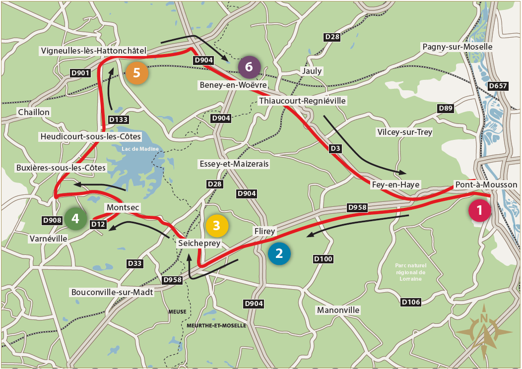
Stop 1: Pont-à-Mousson
Begin in Pont-à-Mousson at the Place Duroc, a large public square with a memorial fountain honoring the American Field Service. Beginning in April 1915, American expatriates volunteered to drive the wounded from the front to hospitals in the rear. The actions of these Americans encouraged others to volunteer and many notable Americans served with the AFS or similar ambulance organizations. Many AFS units and individuals earned the Croix de Guerre and other decorations for their heroic actions. The fountain was dedicated in 1931.
Stop 2: Flirey
There are two monuments at Flirey. On the south side of the road, a monument commemorates the American divisions that recaptured the St. Mihiel Salient and freed French citizens held under German occupation since 1914. In front of the church is a monument to France’s 163rd Infantry Regiment.
Flirey was the right flank of IV Corps. On the night of Sept. 11, 1918, the 89th Division was massed here facing north. The typical three regiments of artillery were doubled for this attack. To the right was the 2nd Division, with its Marine brigade. To the west were the veteran 1st and 42nd Divisions.
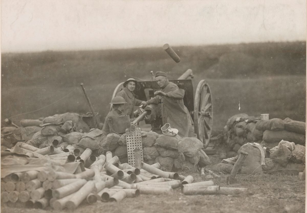
At 1 a.m. on Sept. 12 the attack began with a four-hour artillery bombardment. At 5 a.m. the infantry moved forward behind a rolling barrage. In the first days the 89th advanced an astonishing 8 kilometers through well-prepared positions. The German forces had already begun their withdrawal, and the barbed wire, laid down years before, had become brittle and susceptible to the barrage.
Stop 3: Seicheprey
Seicheprey was the dividing line between the 1st and 42nd Divisions. The fountain adjacent to the playground is a monument to troops from Connecticut who previously fought here. This fountain became the daily source of household water for many villagers and a daily reminder of the American Expeditionary Forces.
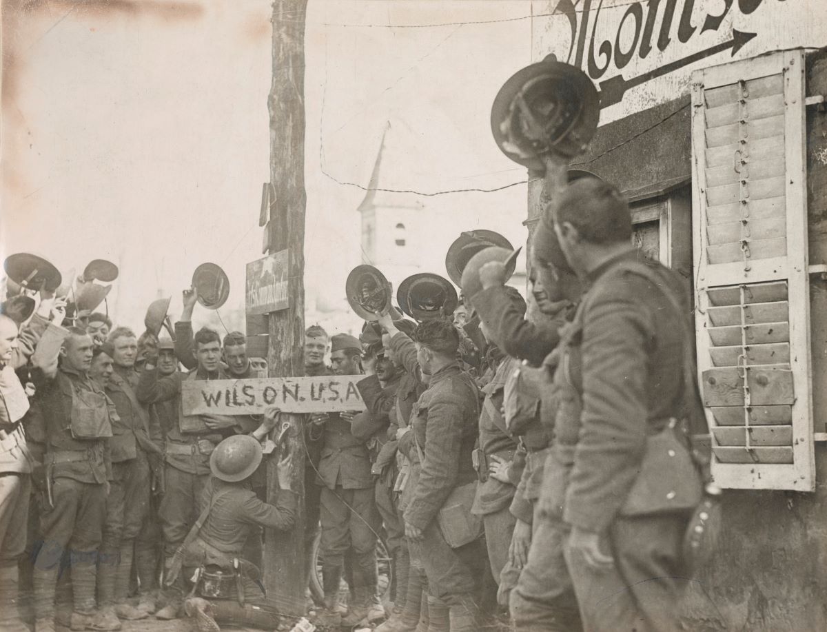
Stop 4: The Montsec American Monument
The Montsec American Monument is a white, circular, open-topped colonnade. In the center on a raised platform is a bronze relief map of the St. Mihiel Salient. Arrows in the floor between the columns point to important sites. The monument commemorates the Battle of St. Mihiel and American actions further south and east in this region. Southeast of the monument you can see the road leading away from Montsec toward Richecourt and Seicheprey.
First Lt. Eddie Rickenbacker visited Montsec and said observers could view aircraft above his airfield at Toul 16 kilometers southeast. The crest of Montsec and the south slope held numerous observation posts. The north side of the hill had many dugout shelters for German defenders.
Trench lines and barbed wire were laid for an all-around defense. On Sept. 12 and 13, Allied artillery blanketed Montsec with a smoke screen obscuring observation.
The 1st and 42nd Divisions advanced from Seicheprey, passing Montsec, heading north. The lakes to your front were smaller then and did not impede the advance. Looking north you can see the end of a ridgeline above Heudicourt-sous-les-Côtes. The 1st Division advanced as far as the forests to the east on the first day in line with the 42nd and 89th Divisions to their right. The final objective of the 1st was Vigneulles-lès-Hattonchâtel, on the second distant ridgeline.
Stop 5: Vigneulles-lès-Hattonchâtel
This monument commemorates the fallen of the 1st Division in the Battle of St. Mihiel, and its meeting with the 26th Division that cut off the salient on Sept. 13, 1918. Both roads to the tip of the salient met in Vigneulles. The two divisions cut off and captured many retreating Germans. To the west of here are the hills of the Côtes de Meuse, which give way to flatlands of the Woëvre plain stretching east.
You can see Montsec directly south. Seicheprey is just beyond and to the left 12 kilometers away. Look north and you will see a ridge and the village of Hattonchâtel.
On the morning of Sept. 13, American fighter pilots of the 27th and 95th Squadrons flew beneath bad weather to observe soldiers of the 26th Division waving from the ridge and in the streets of these towns. The 26th had advanced over 12 kilometers in a little more than a day. The 1st and 42nd Divisions overran the road east of here capturing German troops and material and cutting off their retreat. Further east, American and Allied aircraft converged on the road to attack the retreating enemy.
The advance of the American divisions was remarkable in a war measuring success in hundreds of meters. Their dash was complimented by increasing professionalism. Germans reported that American artillery was accurate, quick to respond to the needs of American infantry, and efficient in preliminary bombardment. The German attempt to withdraw was upset by the rapid advance of the American Expeditionary Forces. The Germans lost 16,000 men, 443 guns, and valuable munitions stores.
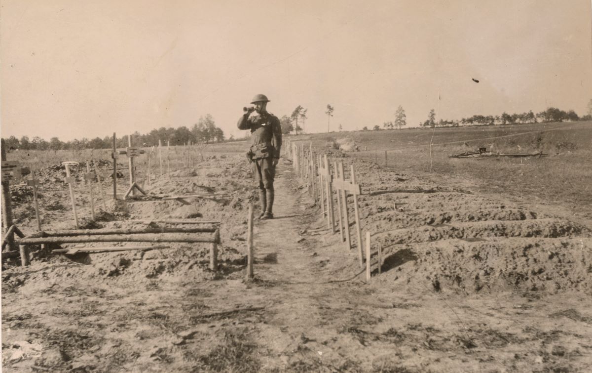
Stop 6: St. Mihiel American Cemetery
This site became a cemetery in September 1918. Today, St. Mihiel American Cemetery contains the graves of more than 4,100 Americans. Of these, the identities of more than 100 are unknown. Most of those interred fell in the St. Mihiel Salient. Tablets in the chapel bear the names of more than 280 missing Americans who died in the area. A rosette on the Tablets of the Missing indicates the individual was later recovered and identified.
When you leave the cemetery you will pass through Thiaucourt, captured on Sept. 12 by the 2nd Division. Thiaucourt became a center of medical services.
Map this route: https://maps.app.goo.gl/zfTopoWcLSq45xut7
Download a PDF of ABMC’s full World War I Battlefield Companion.